Sentier du Château Fort Piana roughly translates to Trail of the Fortified Castle of Piana. This hiking trail leads you to the best viewpoint of the Château Fort Piana (Château Fort de Piana), AKA the Fortified Castle of Piana, which is one of the most striking rock landforms in Calanques di Piana, Corsica.
In this guide, we’ll tell you everything you need to know about doing Sentier du Château Fort Piana.
What Is Sentier du Château Fort Piana?
Sentier du Château Fort Piana is a popular hiking trail in Calanques de Piana, which takes you to an impressive vantage point of an epic rock formation called Château Fort Piana. As the name suggests, the geological landmark resembles that of a fortified castle or stone fortress.
The trail itself is short and easy. So it doesn’t take much time or effort to reach the viewpoint for this natural attraction.
Below, we’ll cover the specific trail stats for this hike.


Sentier du Château Fort Piana Details
This hike is undoubtedly one of the shortest and simplest to do in the Calanques de Piana. By way of comparison, the Calanques di Piana Hike itself is much more challenging.
- Type: Out and Back
- Distance: 1.4km
- Time: 0.5–1 hours
- Accumulated elevation gain: 65m
- Difficulty: Easy
- Trailhead: Google Maps
Sentier du Château Fort Piana Map
This trail is fairly straightforward to navigate. But we recommend using a map, especially if this is your first time doing this walk. We used this digital AllTrails map.
Calanques de Piana Tours


Another way to explore the Calanques de Piana is by boat. Many excellent Calanques de Piana boat tours sail around the Gulf of Porto, offering views of the Château Fort de Piana.
How to Get There
As far as we know, there isn’t any public transport access for this trail. So, ideally, you’ll have your own vehicle and drive to the trilahead. Beck and I hired a car during our 10 day Corsica trip. That way, we could easily access any hike that we wanted to in Corsica, such as this one.
Car Hire


If you don’t have your own car, you should hire one using Discover Cars. Personally, we use Discover Cars and highly recommend them for finding your ideal car hire at an affordable price. Booking online is super easy and the free cancellation policy is great.
To find out more about renting a car with Discover Cars, read our Discover Cars review and Discover Cars Insurance review.
Parking
The best parking option is the small roadside parking area at Tête du Chien, which is conveniently located at the trailhead for Sentier du Château Fort Piana.
There is also a second nearby roadside parking area roughly 100 metres down the road. If the Tête du Chien parking area is full, use this nearby parking option.
Conveniently, there is an alternate trailhead at this nearby parking area. From this trailhead, the trail soon joins the Sentier du Château Fort Piana in the Forêt de Piana (Piana Forest). This means that if you use this alternative parking, you don’t need to road walk to the trailhead at Tête du Chien.
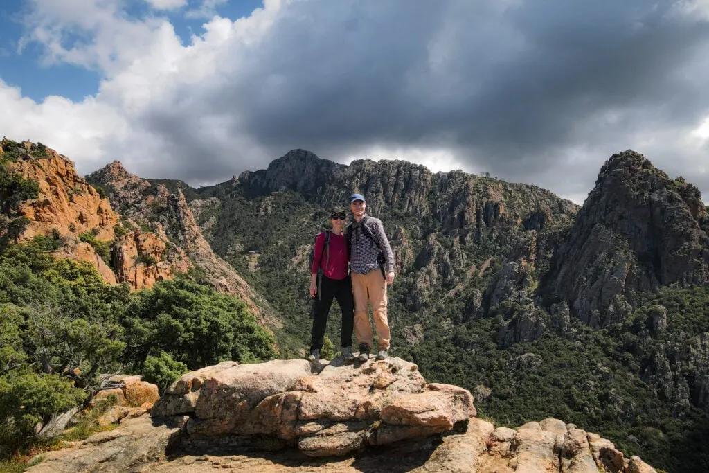
Our Hiking Experience
In the same style that we’ve written our other Corsica walking guides, we won’t bore you with an over-the-top step-by-step trail description. We’ll briefly spotlight the main highlights of the walk, share a bit about our experience, and show you some photos en route.

Tête du Chien (Dog’s Head)
Despite starting Sentier du Château Fort Piana in the middle of the day, we were lucky to get a parking spot at the Tête du Chien parking area.
Albeit, some visitors who park here aren’t hiking to the Château Fort de Piana viewpoint. Some visitors park here to quickly photograph Tête du Chien and are then on their merry way. So, to be fair, there can be a pretty high parking turnover.
Anyway, the first major attraction along Sentier du Château Fort Piana is, of course, Tête du Chien, which translates to Dog’s Head. We suppose it’s pretty self-explanatory why this rock has this name!


Once you pass Tête du Chien, you’ll immediately enter the shade of the Piana Forest. The trail ducks and weaves through the forest, eventually leading to a more open, exposed area.
Just before reaching the main vantage point, you’ll pass by some incredibly shaped rock formations.


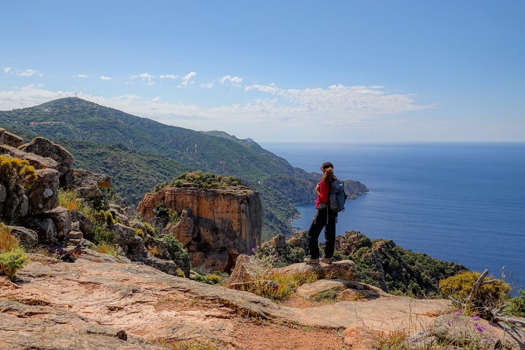
Château Fort de Piana (Fortified Castle of Piana)
Soon enough, you’ll reach a pseudo-plateau, which acts as a terrific viewpoint toward Château Fort de Piana. The formation itself is literally just a rocky outcrop, roughly square in shape. If your imagination is creative enough, you can just about make out a stone fortress!


From this viewpoint, Beck and I not only soaked in the views of this well-known landform but also the surrounding landscape.
In the distance, south of the Gulf of Porto, you’ll see Capo Rosso. We had actually completed the Capo Rosso Hiking Trail that morning. So, it was cool to scope out the headland’s peak that we had hiked up earlier that day.
While Beck took some brilliant photos, I decided to fly my drone. Watch our Corsica Hikes YouTube video for footage of Château Fort de Piana.
After snapping plenty of photos and having a quick rest, we headed back into the forest and retraced our steps to complete the walk.
Is This Hike Worth Doing?
Overall, we think Sentier du Château Fort Piana is a great bang-for-buck walk. For such a short walk, you’ll enjoy an extraordinary view of not only Château Fort de Piana, but of many of the rock formations that make up the Calanques de Piana.
This walk takes less than an hour, so you’ll have plenty of time to do this walk and explore more of the Calanques de Piana.


Corsica Hiking Guides
- Corsica Hikes Guide: The 17 Best Day Hikes in Corsica
- Sentier des Douaniers Cap Corse – The Ultimate Walking Guide
- Sentier des Douaniers Saint-Florent – The Ultimate Walking Guide
- Pointe de la Revellata – The Complete Walking Guide
- Sentier du Facteur Girolata – The Ultimate Hiking Guide
- Sentier du Château Fort Piana – The Complete Walking Guide
- Calanques de Piana Hike via Sentier Muletier (Piana Mule Trail)
- Capo Rosso Hiking Trail – The Ultimate Guide
- Sentier des Crêtes Ajaccio to Monte Salario Walk – Visitor’s Guide
- Sentier des Douaniers Ajaccio – Pointe de la Parata to Petit Capo
- Capu di Muru (Capo di Muro) – The Complete Walking Guide
- Sentier du Littoral de Campomoro – Tour de Campomoro Walk
- Sentier Littoral des Bruzzi (Sentier des Bruzzi) – Visitor’s Guide
- Capo di Feno Bonifacio Walk (Includes Sentier de Fenu)
- Strada Vecia Madonetta – An Excellent Coastal Walk in Bonifacio
- Campu Rumanilu – Bonifacio Cliff Walk (The Ultimate Guide)
Discover Other Hikes in Corsica
Are you interested in doing other hikes in Corsica? Learn about all the best day hikes in Corsica.
Where to Stay Nearby
This trail is located in the heart of the Calanques de Piana, between the villages of Piana and Porto Ota. So, if you want to do this hike, it makes sense to stay in either Piana or Porto Ota.
Personally, Beck and I chose to stay in Porto Ota. We had an unforgettable two-night stay at Hotel et Résidence Cala di Sole. We can certainly vouch for this accommodation and its spectacular views.


Where We Stayed in Porto Ota


- Budget-friendly options with free parking
- Stunning location and views
- Outdoor swimming pool
Leave a comment