Simply put, Corsica is home to many epic hikes. True to form, Beck and I hiked the heck out of Corsica over 10 days, enjoying some of the best hiking on offer in Europe. In this guide, we’ll run through 17 of the best day hikes in Corsica. We’ll also cover all the essential tips and hacks regarding hiking in Corsica to ensure you have a fantastic trip trekking around the island.
Table of Contents
Corsica Hikes Guide: Introduction
Corsica is a French island in the Mediterranean, featuring both incredible mountains and coastline. When it comes to trekking in Corsica, perhaps the most well-known hike is the multi-day GR20 trail.
This is an approx. 180km trail stretching from the north to the south of Corsica, traversing the mountainous area of central Corsica. Usually, the hike takes 16 days to complete.
Indeed, most of the information you’ll find online about hiking in Corsica focuses on GR20.
Sure, Beck and I were tempted by GR20. Unfortunately, we didn’t have enough time to do it. But, we still wanted to hike in Corsica! So, we decided to squeeze in as many single day hikes as we could into a 10 day trip.
By doing so, we’re confident to say that we’ve completed all of the best Corsica day hikes.

Best Day Hikes in Corsica
This blog post will help you discover the best day hikes in Corsica.
Given that Corsica’s landscape features both mountains and the coast, the island offers both incredible mountain and coastal walks.
However, the mountainous central region of Corsica is more favourable to multi-day hikers doing the GR20. Sure, you can do short sections or stages of GR20 as day hikes. And yes, there are standalone day hikes in the Corsican mountains.
But Beck and I were trying to squeeze in as many hikes as possible into our trip. Even the day hikes in the central mountain region were often time-consuming, so we wouldn’t be able to do as many different hikes.
As you would expect, most of the shorter and easily accessible day hikes in Corsica are dotted along the coastline rather than deep into the mountains. So, most of the Corsica day hikes that we did were in the south, west and north coastlines of Corsica, rather than in the central region. This is reflected below!

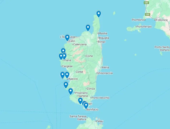
Corsica Hikes Map
For your convenience, we’ve made an interactive map showing the location of 17 of the best day hikes in Corsica. As shown on the map, most of these hikes take place along the north, west, and south coasts of Corsica.

17 Best Day Hikes in Corsica
Without further ado, let’s run through 17 of the best day hikes in Corsica.
To create some order, we’ve listed these Corsica walks by location, covering walks in the north, the west and then the south.
For each hike, we’ve written a brief overview and provided the trail specs. For the vast majority of these hikes, we’ve also included a link to the blog post we’ve written about it. Please feel free to check out these blog posts for further information.


Corsica Hikes in the North
Let’s start with the best day hikes in northern Corsica. This area is well-known for two excellent long coastal paths.
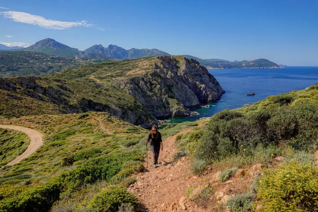
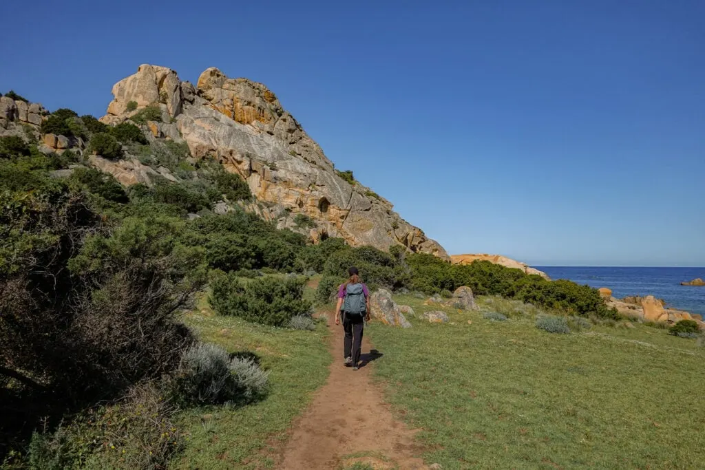
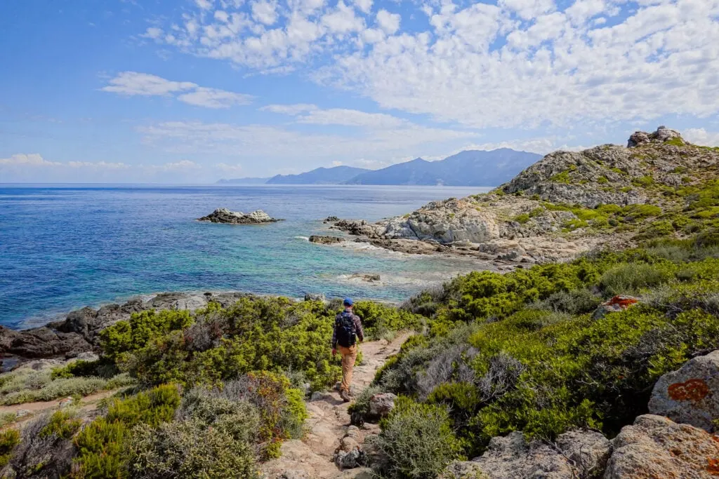
1. Sentier des Douaniers Cap Corse
The Sentier des Douaniers Cap Corse (Customs Officers’ Path of Cape Corse) is one of the best Corsica walking routes. The 23km coastal path stretches across the northern tip of Cape Corse from Centuri in the east to Macinaggio in the west.
Personally, Beck and I took a taxi from Macinaggio to Centuri, then walked west to east from Centuri to Macinaggio.
- Type: One-way
- Distance: 23km
- Time: 6.5–7.5 hours
- Accumulated elevation gain: 700m
- Difficulty: Hard
- Trailhead: Centuri or Macinaggio
- Map: AllTrails
Read more: Sentier des Douaniers Cap Corse – The Ultimate Walking Guide


2. Sentier des Douaniers Saint-Florent
The Sentier des Douaniers Saint-Florent (Customs Officer’s Path of Saint-Florent) is another epic coastal path in northern Corsica. It’s a 37km trail, stretching from Ostriconi in the west to Saint-Florent in the east.
One of the most popular trail options along Sentier des Douaniers Saint-Florent is the 16km coastal walk between the famous Saleccia Beach, Lotu Beach and Saint-Florent. This is the hike that we chose to do. This involved taking a ferry from Saint-Florent to Saleccia Beach, then walking back to Saint-Florent along the coastal path.
- Type: One-way
- Distance: 16km
- Time: 5–6 hours
- Accumulated elevation gain: 200m
- Difficulty: Hard
- Trailhead: Saleccia Beach
- Map: AllTrails
Read more: Sentier des Douaniers Saint-Florent – The Ultimate Walking Guide


Corsica Hikes in the West
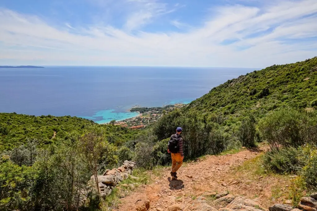
Let’s now look at the best hikes on the west coast of Corsica. Most of the best day hikes in Corsica are on its western side. You’ll find these trails in and around Calvi, Porto Ota and Ajaccio.
3. Pointe de la Revellata
Pointe de la Revellata is a breathtaking peninsula in Calvi. It’s possible to do a circular walk around it, where you’ll see a lighthouse called Phare de la Revellata and a hidden beach called Plage Oscelluccia. By doing this loop walk, you’ll enjoy numerous outstanding coastal vantage points and views.
- Type: Loop
- Distance: 9.2km
- Time: 3–3.5 hours
- Accumulated elevation gain: 345m
- Difficulty: Moderate
- Trailhead: Google Maps
- Map: AllTrails
Read more: Pointe de la Revellata – The Complete Walking Guide

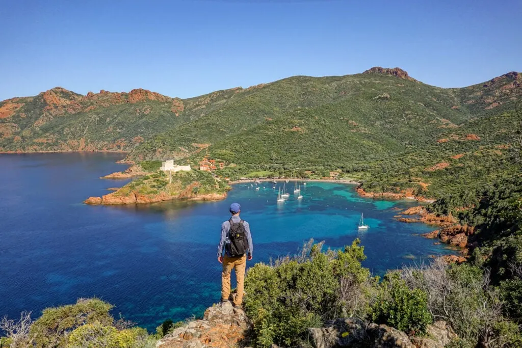
4. Sentier du Facteur Girolata
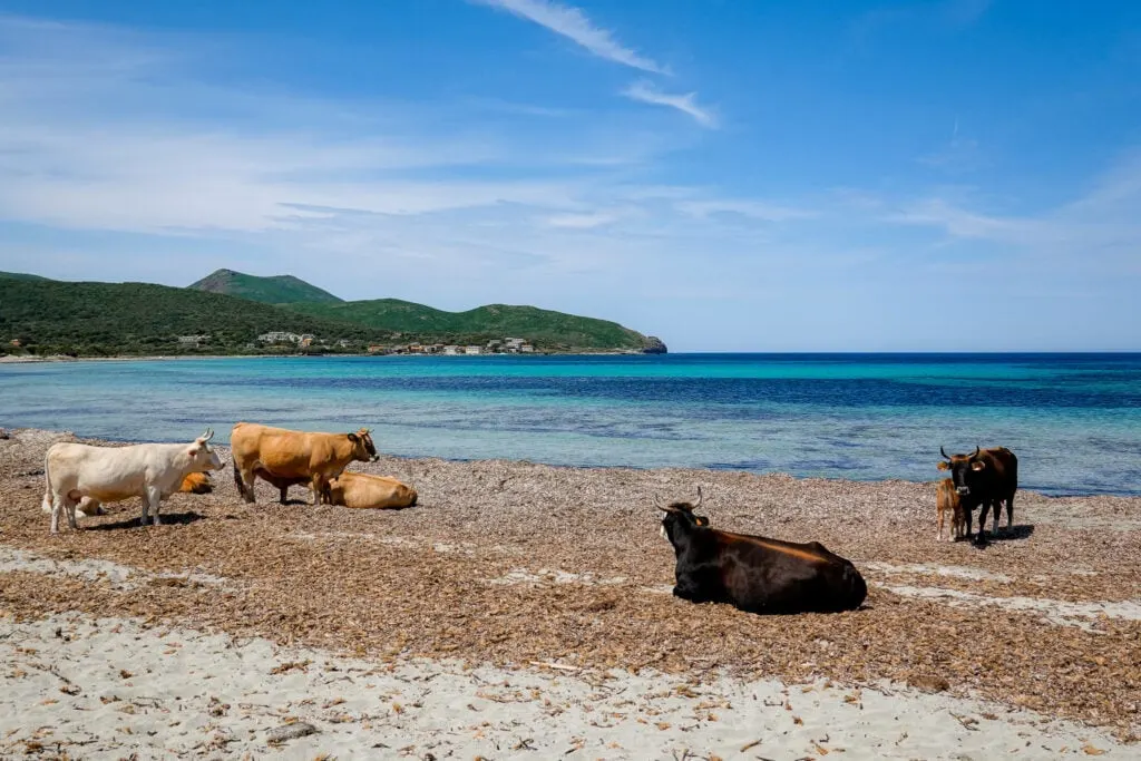
The Sentier du Facteur Girolata (Postman’s Path to Girolata) is hands-down one of the best Corsica hiking trails. Other than visiting the secluded village of Girolata and its tower, the walk visits the well-concealed Tuara Beach, where it’s common to see seaside cows!
- Type: Figure 8
- Distance: 10km
- Time: 3–4 hours
- Accumulated elevation gain: 575m
- Difficulty: Moderate
- Trailhead: Col de la Croix
- Map: AllTrails
Read more: Sentier du Facteur Girolata – The Ultimate Hiking Guide

5. Sentier du Château Fort Piana
Located in the UNESCO World Heritage-listed Calanques di Piana, there is a walk called the Sentier du Château Fort Piana. This roughly translates to the Trail of the Fortified Castle of Piana.
This short hiking trail leads you to the best viewpoint of the Château Fort Piana (Fortified Castle of Piana). This rock formation is definitely one of the most impressive in Calanques di Piana.
- Type: Out and Back
- Distance: 1.4km
- Time: 0.5–1 hours
- Accumulated elevation gain: 65m
- Difficulty: Easy
- Trailhead: Google Maps
- Map: AllTrails
Read more: Sentier du Château Fort Piana – The Complete Walking Guide

6. Calanques de Piana Hike via Sentier Muletier
The Calanques de Piana are a group of stunning red granite rock formations along the west coast of Corsica, in the Gulf of Porto. There are several hiking options in the area.
Beck and I chose to do the Calanques de Piana Hike via Sentier Muletier (Piana Mule Trail). This walk combines a number of trails, including Sentier Muletier, which, altogether, offer some of the most phenomenal views of Calanques di Piana.
- Type: Loop
- Distance: 4.3km
- Time: 2–2.5 hours
- Accumulated elevation gain: 345m
- Difficulty: Moderate
- Trailhead: Stade Municipal de Piana
- Map: AllTrails
Read more: Calanques de Piana Hike via Sentier Muletier (Piana Mule Trail)


7. Capo Rosso Hiking Trail
The Capo Rosso Hiking Trail explores the well-known headland of Capo Rosso, a prominent promontory south of the Gulf of Porto. Undoubtedly, this is one of the most popular hikes in Corsica. From the top of Capo Rosso, you’ll find a watchtower and enjoy some of the most exquisite views of the Corsican coastline.
- Type: Out and Back
- Distance: 8.9km
- Time: 2.5–3 hours
- Accumulated elevation gain: 480m
- Difficulty: Moderate
- Trailhead: Google Maps
- Map: AllTrails
Read more: Capo Rosso Hiking Trail – The Ultimate Guide


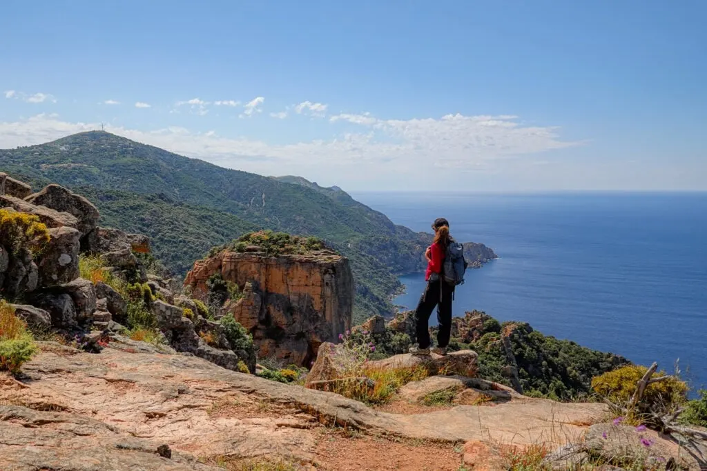
8. Sentier des Crêtes Ajaccio to Monte Salario Walk
The Sentier des Crêtes Ajaccio (Crest/Ridge Trail of Ajaccio) is a walk offering sensational views of Ajaccio, the capital of Corsica. Sentier des Crêtes Ajaccio consists of both a Low Crest and High Crest track.
Beck and I did a circular walk that combined sections of both the Low Crest and High Crest trails. By doing so, we hiked to Monte Salario, which is one of the highest peaks in Ajaccio.
- Type: Loop
- Distance: 9.5km
- Time: 3.5–4 hours
- Accumulated elevation gain: 405m
- Difficulty: Hard
- Trailhead: Bois des Anglais or Chemin du Caniccio
- Map: AllTrails
Read more: Sentier des Crêtes Ajaccio to Monte Salario Walk – Visitor’s Guide

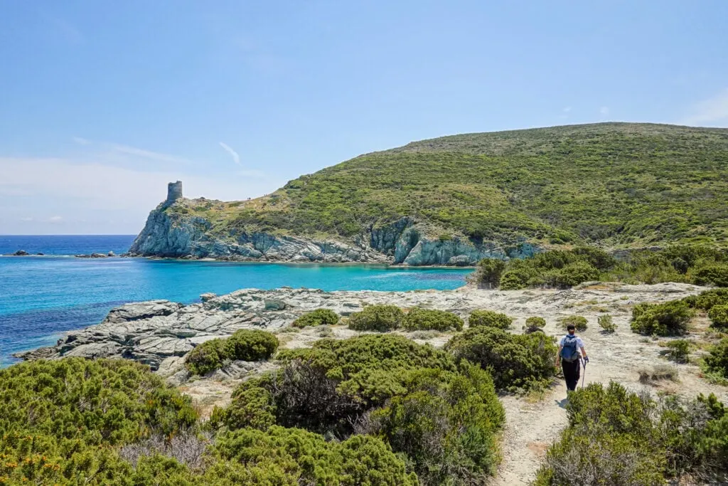
9. Sentier des Douaniers Ajaccio
Sentier des Douaniers Ajaccio (Customs Officers’ Path of Ajaccio) is another great hike in the capital of Corsica. Starting from the Pointe de la Parata Car Park, the trail takes you to a picturesque beach called Plage de Sevani (AKA Petit Capo).
Officially speaking, the walk doesn’t continue further north of Plage de Sevani. But just north of it, there is another beach called Plage du Grand Capo (Grand Capo) that you can definitely check out to extend the walk. Together, Plage de Sevani and Plage du Grand Capo form Capo di Feno (Plage de Capo di Feno).
- Type: Out and Back
- Distance: 7.6km
- Time: 2–2.5 hours
- Accumulated elevation gain: 200m
- Difficulty: Moderate
- Trailhead: Parking Area
- Map: AllTrails
Read more: Sentier des Douaniers Ajaccio – Pointe de la Parata to Petit Capo


10. Pointe de la Parata
Pointe de la Parata is a spectacular headland west of Ajaccio. Technically speaking, Sentier des Douaniers Ajaccio doesn’t include exploring this headland itself. To do Sentier des Douaniers Ajaccio, you park at the headland’s car park, but then head north of it.
Personally, Beck and I did this circular walk around the headland before doing Sentier des Douaniers Ajaccio. Pointe de la Parata is one of the most stunning headlands in Corsica, with great views of Parata Tower (Tour de la Parata) and Sanguinaires Islands (Iles Sanguinaires).
- Type: Loop
- Distance: 4km
- Time: 1–1.5 hours
- Accumulated elevation gain: 115m
- Difficulty: Easy
- Trailhead: Parking Area
- Map: AllTrails


11. Capu di Muru
Capu di Muru is yet another sublime peninsula. There is a circuit trail that encircles much of the cape. By doing this hike, you’ll reach the cape’s western tip, where you’ll find some of the most remarkable rock formations.
- Type: Loop
- Distance: 8.7km
- Time: 2.5–3 hours
- Accumulated elevation gain: 265m
- Difficulty: Moderate
- Trailhead: Parking Area
- Map: AllTrails
Read more: Capu di Muru (Capo di Muro) – The Complete Walking Guide


12. Sentier du Littoral de Campomoro
Sentier du Littoral de Campomoro (Campomoro Coastal Trail) is a mind-blowing coastal path stretching 22km between Campomoro and Tizzano in the southwest of Corsica.
Along this coastal trail, there are several hiking options. Beck and I chose to do an extended version of the Canuseddu Loop by initially visiting Campomoro Tower (Tour de Campomoro).
- Type: Loop
- Distance: 8.8km
- Time: 2.5–3 hours
- Accumulated elevation gain: 240m
- Difficulty: Moderate
- Trailhead: Campomoro
- Map: AllTrails
Read more: Sentier du Littoral de Campomoro – Tour de Campomoro Walk

Corsica Hikes in the South
Last but not least, we’ll now cover the best hikes in southern Corsica.
13. Sentier Littoral des Bruzzi
Sentier Littoral des Bruzzi (Bruzzi Coastal Trail) is a lesser-known coastal walk in Corsica. This is certainly one of the most underrated day hikes on the island. The short circular walk visits four small yet exceptional beaches. We did this hike at sunrise, which we highly recommend.
- Type: Loop
- Distance: 5km
- Time: 1.5 hours
- Accumulated elevation gain: 115m
- Difficulty: Easy
- Trailhead: Parking area
- Map: AllTrails
Read more: Sentier Littoral des Bruzzi (Sentier des Bruzzi) – Visitor’s Guide


14. Capo di Feno Bonifacio Walk
Capo di Feno is a marvellous cape situated in the Bonifacio area. There is a circular walk around the cape, which takes in all of its distinctive points of interest. Part of this loop walk is a section called Sentier de Fenu, a track that connects the trailhead to the Capo di Feno Lighthouse.
- Type: Loop
- Distance: 9.5km
- Time: 2.5–3 hours
- Accumulated elevation gain: 300m
- Difficulty: Moderate
- Trailhead: Bocca d’Arbia (Google Maps)
- Map: AllTrails
Read more: Capo di Feno Bonifacio Walk (Includes Sentier de Fenu)

15. Strada Vecia Madonetta
Strada Vecia Madonetta is also known as Sentier de Strada Vecia et Madonetta, which roughly translates to Path of the Old Road and Madonetta.
From the enchanting town of Bonifacio, you’ll follow an old Roman road called Strada Vecia to reach the gorgeous Paragan Beach. Afterwards, you’ll follow a different coastal trail to the majestic Madonetta Lighthouse, passing spectacular hidden beaches along the way.
- Type: Loop
- Distance: 10.1km
- Time: 3–3.5 hours
- Accumulated elevation gain: 305m
- Difficulty: Moderate
- Trailhead: Bonifacio (Google Maps)
- Map: AllTrails
Read more: Strada Vecia Madonetta – An Excellent Coastal Walk in Bonifacio


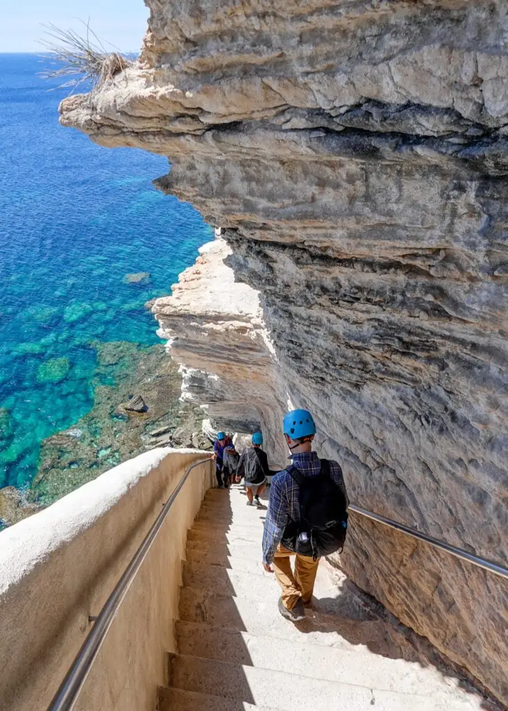
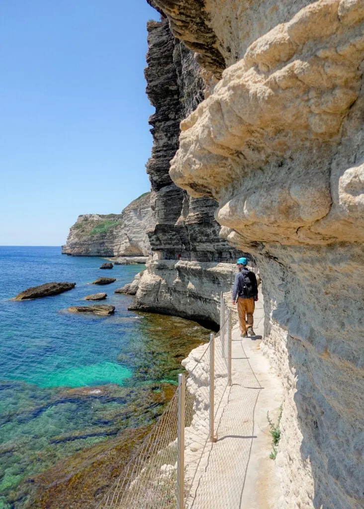
16. Escalier du Roi d’Aragon
Escalier du Roi d’Aragon (King of Aragon’s Staircase) is a set of steep steps carved into the cliffside of Bonifacio. Exploring the 45-degree angled staircase, featuring 187 (or 189, depending on what you read) steps, is an unforgettable experience.
After descending the steps, a short trail winds around the cliffside, offering fantastic views of Sardinia!
- Type: Out & Back
- Distance: 500 metres
- Time: 30 minutes
- Accumulated elevation gain: 65m
- Difficulty: Moderate
- Trailhead: Bonifacio


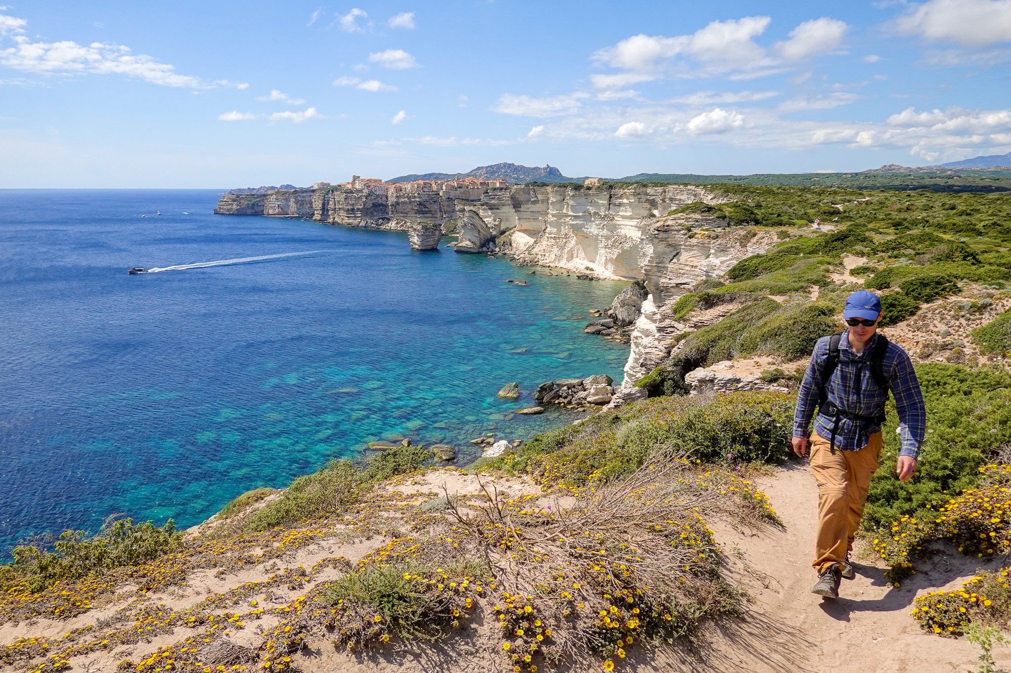
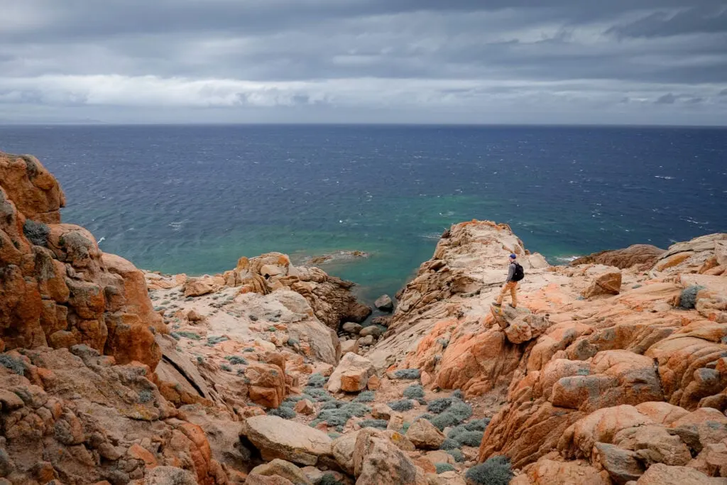
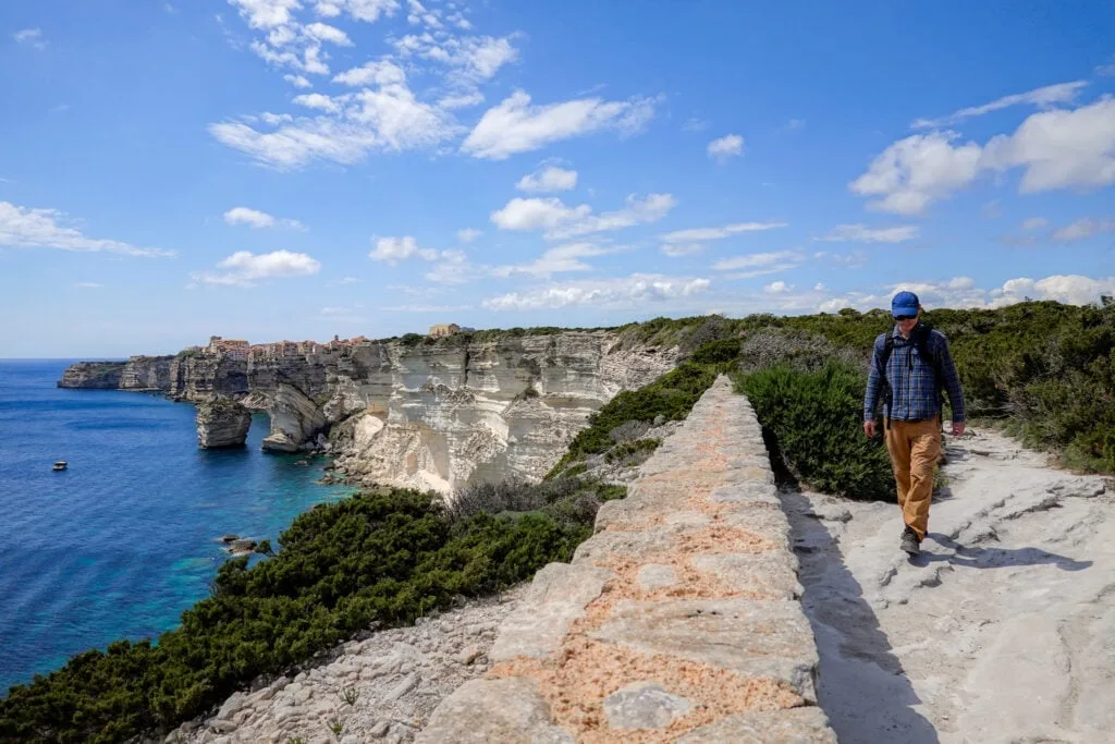
17. Campu Rumanilu: Bonifacio Cliff Walk
The Campu Rumanilu trail, which is also known as the Bonifacio Cliff Walk, is perhaps one of the best hikes in Corsica. As the name suggests, this is the walk to do to explore the majestic white sandstone cliffs surrounding Bonifacio.
Beck and I chose to extend the walk to Capo Pertusato. By doing so, we visited the Lighthouse of Pertusato and enjoyed stunning views of Saint Antoine Beach. We highly recommend doing this extended version to explore even more excellent views of the stunning Bonifacio Cliffs (map).
- Type: Out & Back
- Distance: 3.5km
- Time: 1–1.5 hours
- Accumulated elevation gain: 130m
- Difficulty: Easy
- Trailhead: Col Saint Roch (Google Maps)
- Map: AllTrails
Read more: Campu Rumanilu – Bonifacio Cliff Walk (The Ultimate Guide)

Practical Tips For Hiking in Corsica, France
Now you know about all the best day hikes in Corsica, let’s discuss some practical tips about hiking on the island. By following these tips, you’ll maximise your enjoyment of hiking in the area and increase your confidence regarding safety.
- Pack plenty of water and snacks for your hikes. Given the typical hot weather in Corsica, even for shorter hikes, you’ll want to take plenty of water to stay hydrated.
- Wear and use appropriate hiking gear. Many of the hiking trails described in this blog post consist of uneven, rocky terrain. Depending on your capability, you may want to consider wearing sturdy hiking boots and using trekking poles.
- Layer appropriately. Even though Corsica typically has hot weather, it’s much colder in the mountains, especially during winter. If you’re venturing into the mountains, pack your layers!
- Download an offline version of an interactive GPS-guided map before you arrive at the trailhead. We did this using AllTrails, which allowed access to interactive maps even when phone reception was poor.
- For the two point-to-point walks in the north of Corsica, make sure to book your transport well in advance to avoid missing out.
- Read hiking guidebooks for even more trail options and details. We used Walking on Corsica by Gillian Price and Corsica: The Finest Coastal and Mountain Walks by Klaus Wolfsperger to help plan our trip.

How to Get Around
To access most of the hikes described in this blog post, you’ll need to drive to the trailhead. Beck and I hired a car for our 10 day Corsica trip, which helped us zip around the island and do as many hikes as we liked!
Car Hire


If you don’t have your own car, you should hire one using Discover Cars. Personally, we use Discover Cars and highly recommend them for finding your ideal car hire at an affordable price. Booking online is super easy and the free cancellation policy is great.
To find out more about renting a car with Discover Cars, read our Discover Cars review and Discover Cars Insurance review.
Suggested Corsica Hikes Itinerary
We completed all 17 of these trails during our 10 day Corsica hiking trip. If you want to do the same, we recommend following our itinerary.
- Bonifacio: 3 nights (hikes in the south of Corsica)
- Ajaccio: 2 nights (hikes in the west of Corsica)
- Porto Ota: 3 nights (hikes in the west of Corsica around Calanques di Piana)
- Bastia: 3 nights (hikes in the north of Corsica)


Where to Stay
Where you stay in Corsica will depend on what hikes you want to do. As you can see from our itinerary, we stayed in Bonifacio, Ajaccio, Porto Ota and Bastia to do all of the hikes described in this blog post.
Travel Insurance
Of course, you should buy travel insurance for any trip. We ensured we had travel insurance before setting out on our Corsica hiking trip.
Heymondo is one of the best budget travel insurance providers on the market. They provide comprehensive travel and medical insurance that won’t break the bank. Whether it’s single trip insurance, annual multi-trip insurance or long stay insurance, Heymondo offers affordable travel and medical insurance to suit all of your needs. Personally, we use Heymondo travel insurance and highly recommend it. To find out more about Heymondo travel and medical insurance, read our Heymondo travel insurance review.
Travel Insurance


Don’t leave for your trip without booking travel insurance. We all know accidents can happen and having Heymondo travel insurance could save you thousands of dollars if something goes wrong. Click the button below to receive a 5% discount!
FAQs
Let’s cover a few commonly asked questions about hiking in and visiting Corsica.


How to Get to Corsica?
Corsica is home to two main airports, one in Bastia and one in Ajaccio, which is the capital city. Personally, Beck and I flew into Bastia from London.
It’s also possible to get to Corsica by ferry from some destinations in France and Italy.
When Is the Best Time to Hike in Corsica?
Considering summer is peak season, and winter brings less favourable weather, possibly the best time to visit is in the shoulder seasons, in autumn and spring. Beck and I visited Corsica in May. This was a good time of year to hike, as it fell outside the busier summer months, while the weather was relatively mild.
When it comes to the time of day to hike, you’ll want to walk earlier or later to avoid the heat, especially on coastal walks.
Is Corsica An Expensive Hiking Destination?
Yes, Corsica is a relatively expensive island to visit. So, it’s by no means a budget hiking destination.
Read our other Mediterranean destination hiking guides: Malta, Mallorca, Menorca and Sicily.
Leave a comment