The Capo Rosso Hiking Trail is perhaps the most popular hike in Corsica, and for good reason. If you’re visiting the west of Corsica and enjoy hiking, you’ll want to add this walk to your itinerary.
Beck and I thoroughly enjoyed doing this hike and look forward to telling you everything you need to know about doing it, so you can hopefully enjoy it too!
Table of Contents
About the Capo Rosso Hiking Trail
As the name suggests, the Capo Rosso Hiking Trail explores Capo Rosso (AKA Capu Rossu), a prominent headland south of the Gulf of Porto. The cape is located on the west coast of Corsica near the village of Piana.
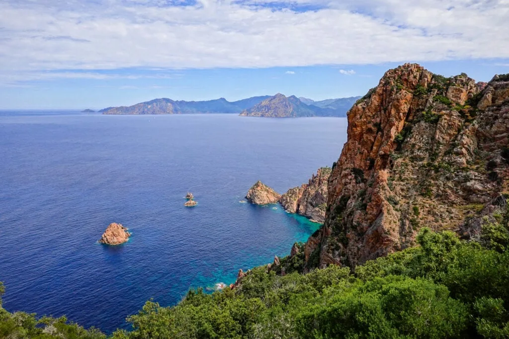
The cape is well-known as one of Corsica’s standout natural attractions. Remarkable red granite cliff formations characterise the cape. Plus, the cape’s peak, which features a Genoese tower, offers exceptional panoramic views of the Gulf of Porto and the surrounding landscape.
Given its natural beauty, it’s no surprise that the Capo Rosso Hiking Trail is part of a UNESCO World Heritage site, which broadly encompasses the Calanques de Piana.
Undoubtedly, it’s one of Corsica’s premier hikes. Because of its popularity, this was one of the busier hiking trails we did in Corsica. The crowds were the only drawback of this otherwise exhilarating and captivating walk.
Below, let’s look at the trail stats for this hike.

Capo Rosso Hiking Trail Details
The Capo Rosso Hiking Trail is of moderate length and difficulty with a reasonably significant elevation gain. With that said, the out-and-back walk is easy to navigate, but it’s physically demanding.
- Type: Out and Back
- Distance: 8.9km
- Time: 2.5–3 hours
- Accumulated elevation gain: 480m
- Difficulty: Moderate
- Trailhead: Google Maps
Explore Capo Rosso By Boat


Another way to see Capo Rosso is from the water. Many excellent Calanques de Piana boat tours sail around the Gulf of Porto, offering exceptional views of the headland.
Capo Rosso Hiking Trail Map
If you want convenient Capo Rosso Hiking Trail directions, we recommend using this AllTrails map. As mentioned, trail navigation is relatively straightforward. But we generally advise having a map to hand for any hike you’re setting out on for the first time.

How to Get There
The best way to access this hike is by driving to its trailhead. That’s precisely what Beck and I did!
Unfortunately, as far as we’re aware, there are no public transport options for accessing this hike. During our 10 day trip in Corsica, Beck and I hired a car, and this allowed us to easily access this hike.
Car Hire


If you don’t have your own car, you should hire one using Discover Cars. Personally, we use Discover Cars and highly recommend them for finding your ideal car hire at an affordable price. Booking online is super easy and the free cancellation policy is great.
To find out more about renting a car with Discover Cars, read our Discover Cars review and Discover Cars Insurance review.
Capo Rosso Hiking Trail Parking
There is a large car park at the trailhead for this hike, located here. Even from the parking area, you’ll see decent views of the cape’s peak in the distance.
Our Experience Hiking Up Capo Rosso
Rather than write a tedious step-by-step guide, we’ll briefly detail the walk by covering our experience exploring the main points of interest and showing you some photos.
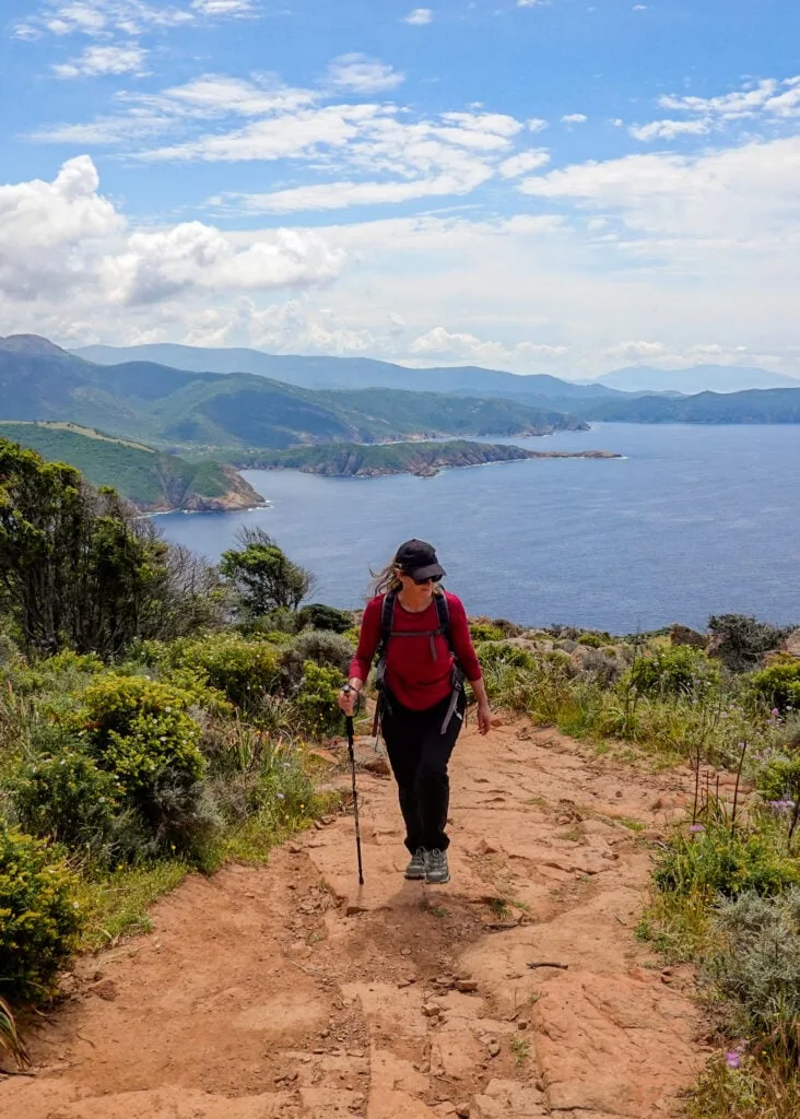
At the northern end of the parking area, you’ll find the trailhead for this hike. Immediately, once you begin following the track, you’ll enjoy splendid, far-reaching views of the cape and the surrounding coastline.


During the initial stages, the trail undulates and winds, gradually descending through dense pockets of shrubland and trees.
Eventually, you’ll pass a water fountain and a small building. You’ll then reach a flat meadow area, which heads to the base of the cape’s steep peak. Beck and I did this hike in May, so we enjoyed many beautiful spring wildflowers.


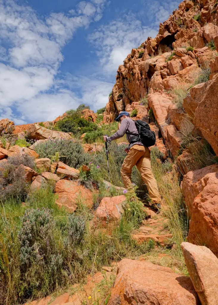
Once you reach the base of the cape’s rocky peak, you’ll begin ascending a steep series of switchbacks. This is definitely the hardest section of the Capo Rosso Hiking Trail.
Expect to be huffing and puffing as you make your way up to the peak. You can also expect sublime coastal views. So, it’s absolutely worth it!


Tower of Turghju
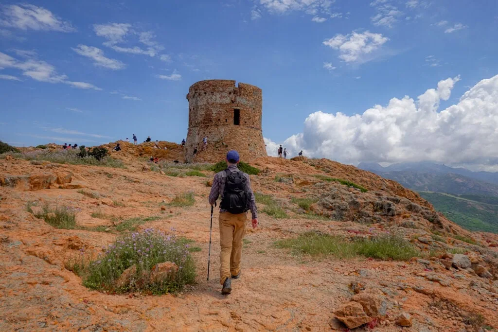
After climbing the arduous switchbacks, you’ll finally arrive atop Capo Rosso. When you near the peak, you’ll probably notice two things. First, a tower in ruins!
Tower of Turghju (Torra di Turghju), which is also known as Capo Rosso Tower, is of Genoese origin, dating back to the early 17th Century. Despite the tower being in ruins, it’s still in pretty good nick and sits majestically atop the peak.
The second thing you’ll likely notice is people! As mentioned, the Capo Rosso Hiking Trail is one of the most popular walks on the island. We set out to do this walk relatively early and still encountered plenty of people at the top.

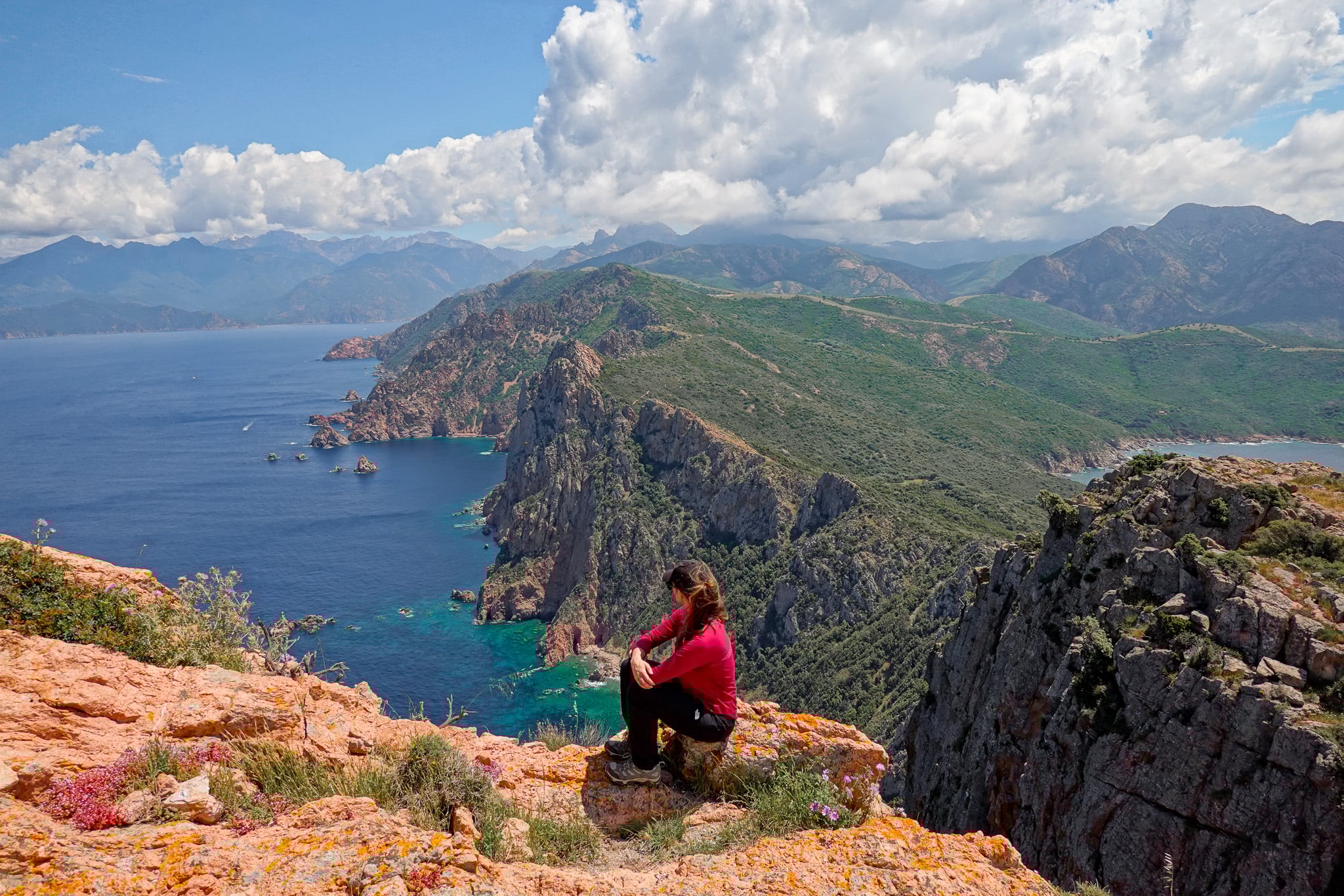
Perhaps, the best part of reaching the headland’s peak is enjoying the widespread views. From over 330 metres above sea level, you’ll enjoy one of the most picturesque views in Corsica. You’ll get to soak in the classic Corsican landscape, one that is filled with rugged mountains near the spectacular coastline.


During our time atop Capo Rosso, we rested, had a bite to eat, and flew our drone.
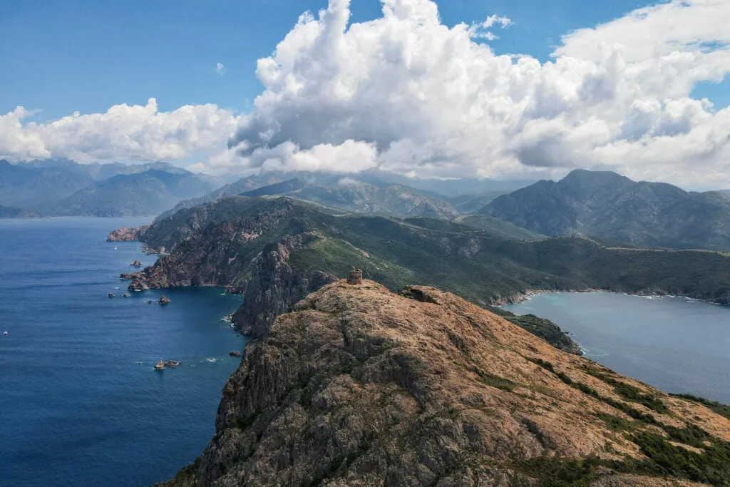
To be honest, I don’t think the aerial photos we took were any better than the conventional photos we took from the peak. Probably my favourite aerial photo, which provided a point of difference, is the one below that captures an opposing view of the cape’s eastern cliff wall.


If you want to check out some epic aerial video of Capo Rosso, please feel free to check out our Corsica Hikes YouTube video.
After soaking in the incredible coastal views, we made our way back down the cape’s rocky prominence. From there, we retraced our steps, gradually ascending our way back to the trailhead.
Capo Rosso Hiking Trail FAQs
Here are some of the most commonly asked questions about this hike.


What Is the Capo Rosso Hiking Trail Difficulty?
Beck and I rate the hike as moderate difficulty. But this is all a matter of opinion. AllTrails rates this walk as hard.
Perhaps, for an experienced hiker, a fair trail rating is moderate difficulty. That’s because of a somewhat modest distance and easy trail navigation, with no technical sections. Of course, there is a significant accumulated elevation gain, which is quite physically demanding to tackle. So, all in all, let’s go with medium difficulty!
When Is the Best Time to Visit?
Because summer is peak season, and winter has poorer weather, perhaps the best time to visit is in the shoulder seasons, in autumn and spring. That way, you enjoy milder weather and avoid the busiest time of year. As mentioned, Beck and I hiked in spring, and we really enjoyed hiking Capo Rosso that time of year, as it was wildflower galore.
What Is the Best Time of Day to Hike?
To beat the heat, you’ll want to do this walk earlier or later in the day. Because sunrise and sunset bring an extra tint of red to the rocks, you may want to do this walk around dawn or dusk. This is also a great way to avoid the crowds.
Of course, if you do complete this walk around sunset, make sure to allow yourself enough time to finish before it gets dark.
Corsica Hiking Guides
- Corsica Hikes Guide: The 17 Best Day Hikes in Corsica
- Sentier des Douaniers Cap Corse – The Ultimate Walking Guide
- Sentier des Douaniers Saint-Florent – The Ultimate Walking Guide
- Pointe de la Revellata – The Complete Walking Guide
- Sentier du Facteur Girolata – The Ultimate Hiking Guide
- Sentier du Château Fort Piana – The Complete Walking Guide
- Calanques de Piana Hike via Sentier Muletier (Piana Mule Trail)
- Capo Rosso Hiking Trail – The Ultimate Guide
- Sentier des Crêtes Ajaccio to Monte Salario Walk – Visitor’s Guide
- Sentier des Douaniers Ajaccio – Pointe de la Parata to Petit Capo
- Capu di Muru (Capo di Muro) – The Complete Walking Guide
- Sentier du Littoral de Campomoro – Tour de Campomoro Walk
- Sentier Littoral des Bruzzi (Sentier des Bruzzi) – Visitor’s Guide
- Capo di Feno Bonifacio Walk (Includes Sentier de Fenu)
- Strada Vecia Madonetta – An Excellent Coastal Walk in Bonifacio
- Campu Rumanilu – Bonifacio Cliff Walk (The Ultimate Guide)
Discover Other Hikes in Corsica
Are you interested in doing other hikes in Corsica? Learn about all the best day hikes in Corsica.
Where to Stay Nearby
Capo Rosso is located near the village of Piana. Most people visiting the cape are also visiting the wider Calanques de Piana area, which is essentially wedged between the villages of Piana and Porto Ota. So, it makes sense to stay in either Piana or Porto Ota.
Personally, Beck and I chose to stay in Porto Ota. We had a memorable two-night stay at Hotel et Résidence Cala di Sole. We can certainly vouch for this accommodation!
Where We Stayed in Porto Ota

- Budget-friendly options with free parking
- Stunning location and views
- Outdoor swimming pool
Leave a comment