The Calanques de Piana (AKA Calanches de Piana) are one of the most extraordinary natural attractions in Corsica. Hiking in the area is one of the best ways to experience the best vantage points of this spectacle. There are a few trail variations that allow you to explore the area. Personally, Beck and I did a Calanques de Piana hike via Sentier Muletier (AKA the Piana Mule Trail).
In this guide, we’ll show you this amazing Calanques de Piana hike that we did. Before we go into detail about this hike, we’ll show you some of the other hiking options and route variations.
Table of Contents
What Are the Calanques de Piana?
The Calanques de Piana are stunning red granite rock formations found on the west coast of Corsica along the Gulf of Porto. This immense geological landscape is deservedly UNESCO World Heritage listed.
Most visitors will simply drive through the area or take a boat trip in the Gulf of Porto to admire the natural terrain. However, several walking tracks in the area offer unique perspectives of this attraction that are otherwise unseen.
Without further ado, let’s go through some of the main hikes in the Calanques de Piana.


Calanques de Piana Hiking Options
This Office National des Forêts (ONF) Corsica map wonderfully depicts hikes in the area.


Surrounding the Calanques de Piana are several mountains, such as Capu d’Ortu, Foce d’Orto, and Capu di u Vitullu, each with its own trail. These mountain hikes would undoubtedly provide unbelievable views of the surrounding area. However, each of these walks are long, time-consuming and very difficult.
Beck and I would have loved to have completed one of these mountain hikes. We were close to choosing to do Sentier du Capu d’Ortu. But time wasn’t on our side.
If you don’t have the luxury of time and want to do a shorter walk in the Calanques de Piana, there are two noteworthy options.
First, there is the 3km Sentier Muletier circuit trail. This hike involves following Sentier Muletier and then returning via the D81 road. One advantage of this option via the road is slowly taking in the breathtaking views of the area from the roadside, such as the Heart in Rock. However, we didn’t really fancy unnerving and crowded road walking.


Rather, we chose to do a 4.3km Calanques de Piana Hike via Sentier Muletier. This hike also involves Sentier Muletier but avoids a long section of road walking. Instead, the loop is completed by following a combination of higher walking trails. This walk is also known as Source des Roches Bleues to Calanques de Piana.
Below, we’ll tell you more about this specific walk that Beck and I did.
Calanques de Piana Hike via Sentier Muletier
We think the Calanques de Piana via Sentier Muletier is the best short walk that explores the heart of this natural attraction. By doing this hike, you’ll do much less road walking. Instead, you’ll experience more natural hiking trails at much higher elevations, offering more amazing viewpoints and scenes.
Sure, you’ll have to climb higher and work harder for these views. But rest assured, it’s 100% worth it!


Calanques de Piana Hike Details
These are the key trail specs for this walk. Given the distance, it’s a significant amount of elevation gain. So, despite the distance, the walk actually takes around two hours.
- Type: Loop
- Distance: 4.3km
- Time: 2–2.5 hours
- Accumulated elevation gain: 345m
- Difficulty: Moderate
- Trailhead: Stade Municipal de Piana
Calanques de Piana Hike Map
We highly recommend using a map (AllTrails) to help with trail navigation.


How to Get There
The best way to get to the trailhead for the walk is by driving. As far as we know, there aren’t any public transport options.
Car Hire


If you don’t have your own car, you should hire one using Discover Cars. Personally, we use Discover Cars and highly recommend them for finding your ideal car hire at an affordable price. Booking online is super easy and the free cancellation policy is great.
To find out more about renting a car with Discover Cars, read our Discover Cars review and Discover Cars Insurance review.
Parking
There is a parking area by a poorly maintained football field, where the hike starts.
Hiking Calanques de Piana via Sentier Muletier
From the overgrown football pitch, you’ll use a footbridge to cross over Ruisseau de Dardo (Dardo Stream).
Soon enough, you’ll reach an intersection. To turn left is to follow Sentier Muletier, which is an option, if you like. Personally, Beck and I chose to do this walk in an anti-clockwise direction. So, we turned right at the intersection, following the shared trail of Sentier Palami and Sentier de Capu di u Vitullu.
After a fairly arduous ascent, you’ll soon reach a dense forest, where the trail kindly flattens. At this point of the walk, Calanques de Piana is out of sight.


Eventually, you’ll reach another intersection. You’ll turn left, following and descending a section of Sentier du Capu d’Ortu towards the coastline. It’s during this part of the hike that you’ll start to enjoy amazing views of Calanques de Piana and the surrounding Gulf of Porto.


Source des Roches Bleues
The descent finally leads you to a site called Source des Roches Bleues, which is near the roadside. Once you arrive on the road, you’ll pass Les Roaches Bleues, which is a well-known restaurant. You’ll follow the road for around 300 metres before arriving at the northern end of Sentier Muletier.


Sentier Muletier (Piana Mule Trail)
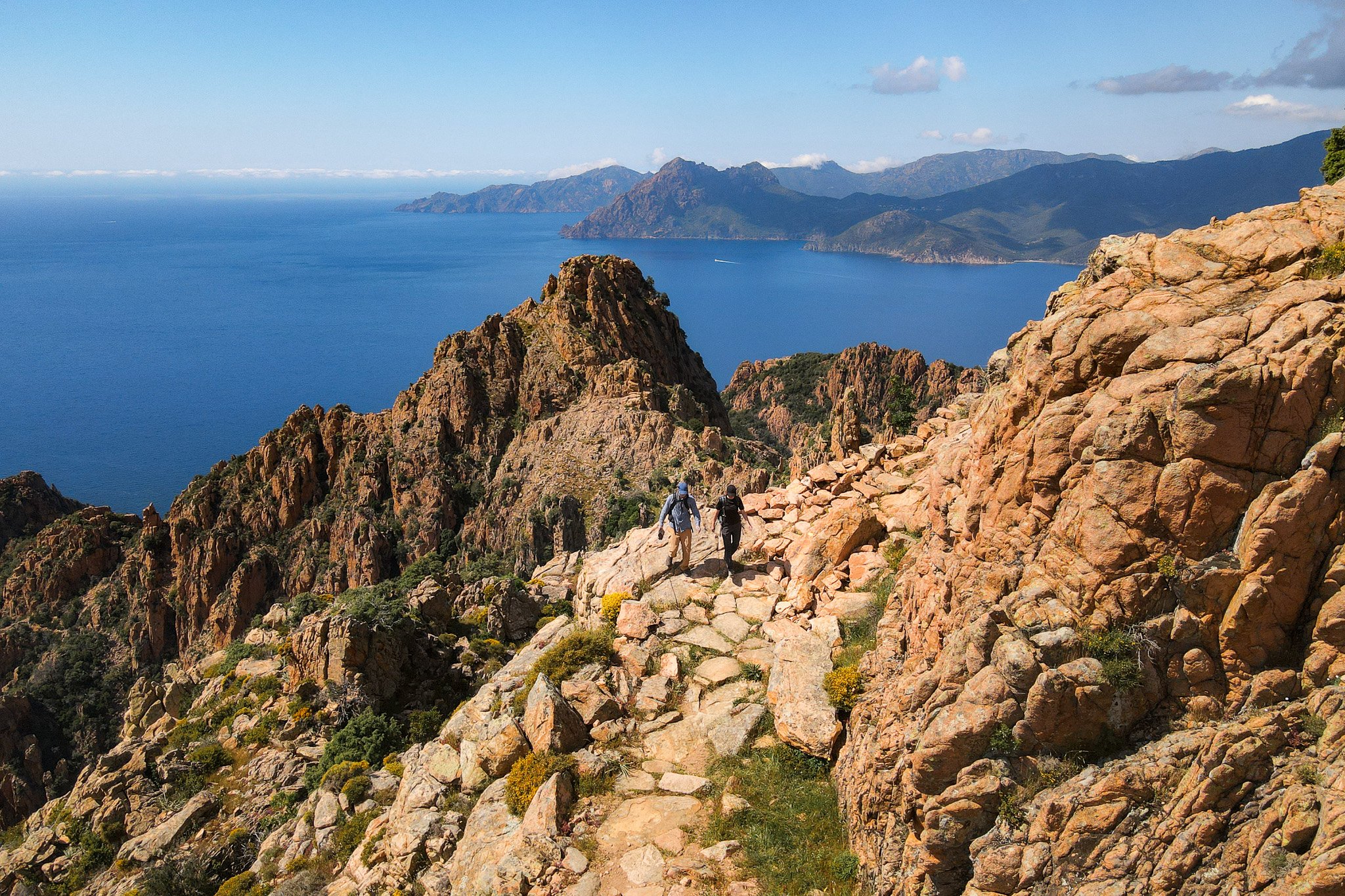
Upon entering Sentier Muletier, there is a series of switchbacks to climb up. It’s hard yacker, but once you reach the highest sections of this trail, you’ll enjoy some of the most sublime views of Calanques de Piana.


Perhaps the mid-to-southern end of Sentier Muletier features the best vantage points in the area. Not only are the views mindblowing, but the trail’s balcony-like structure is truly epic. Beck and I agreed that this part of the walk was our favourite.
During this section of the walk, we slowed right down to soak in the views. We made sure to take plenty of photos here and even flew our drone (check out our Corsica Hikes YouTube video to scope out the footage).


From the balcony section of Sentier Muletier, you’ll descend the remainder of the trail, finding your way back to the start in no time.
Calanques de Piana Hike Practical Tips
Beck and I thoroughly enjoyed doing the Calanques de Piana Hike via Sentier Muletier. We think you’ll enjoy this walk just as much as we did, especially if you follow these practical tips.
- Download an offline version of an interactive GPS-guided map before you arrive. We did this on AllTrails, which gave us access to an interactive map even when phone reception was poor in mountainous areas.
- Pack plenty of water and snacks. Even though the walk described in the guide is only around 4km, there is significant elevation gain. So, you’ll need more water and food than you think, especially if it’s hot.
- Fill your day with another hike. Despite the Calanques de Piana Hike via Sentier Muletier’s relative difficulty, it should only take around two hours. So, you’ll have plenty of time for another walk, if your heart desires. Personally, we did Sentier du Facteur Girolata in the morning, then this walk in the afternoon.
- Use and wear appropriate hiking gear. As expected, all the hiking trails in the area have uneven, rocky surfaces. Depending on your skill and fitness level, you may want to consider sturdy hiking boots and even trekking poles.
- If you’re scared of heights, you may want to stick to driving or boating around Calanques de Piana!
For more practical tips, check out the FAQs below.
Calanques de Piana Hike FAQs
These are some of the most frequently asked questions about this walk.
What Is the Calanques de Piana Hike Length?
The walk that we focused on in this guide is 4.3km long.
When Is the Best Time to Visit?
Considering summer is peak season, and winter brings less favourable weather, perhaps the best time to visit is in the shoulder seasons, in autumn and spring. Personally, Beck and I visited in May. This was a good time of year to visit, as it fell outside the busier summer months, while the weather was very nice, yet not too sweltering.
What Is the Best Time of Day to Hike?
Of course, to beat the heat, you’ll want to do this walk earlier or later in the day. Because sunset brings an extra splash of orange hue to the rocks, you may want to do this walk around sunset. Just make sure to allow yourself enough time to complete the walk before it goes dark.
Is the Hike Safe For Children?
The Calanques de Piana Hike via Sentier Muletier, discussed in this guide, is quite physically demanding. Perhaps the more appropriate walk for families with younger kids is the Sentier Muletier on its own. To avoid road walking, which is generally less safe, you may choose to do an out and back walk of Sentier Muletier.
Other Hikes Near Calanques de Piana
There are plenty of other outstanding hikes in the area. In the immediate vicinity, there is Sentier du Château Fort Piana. This walk takes you to a viewpoint of the majestic Château Fort rock formation.
Just south of the Calanques de Piana, the Capo Rosso Hiking Trail is one of the most popular hikes in Corsica.


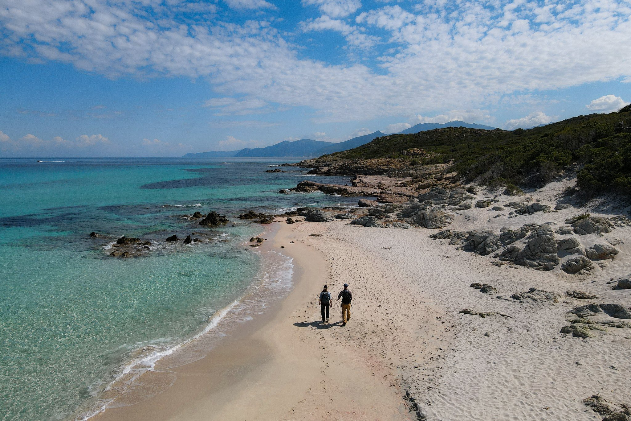
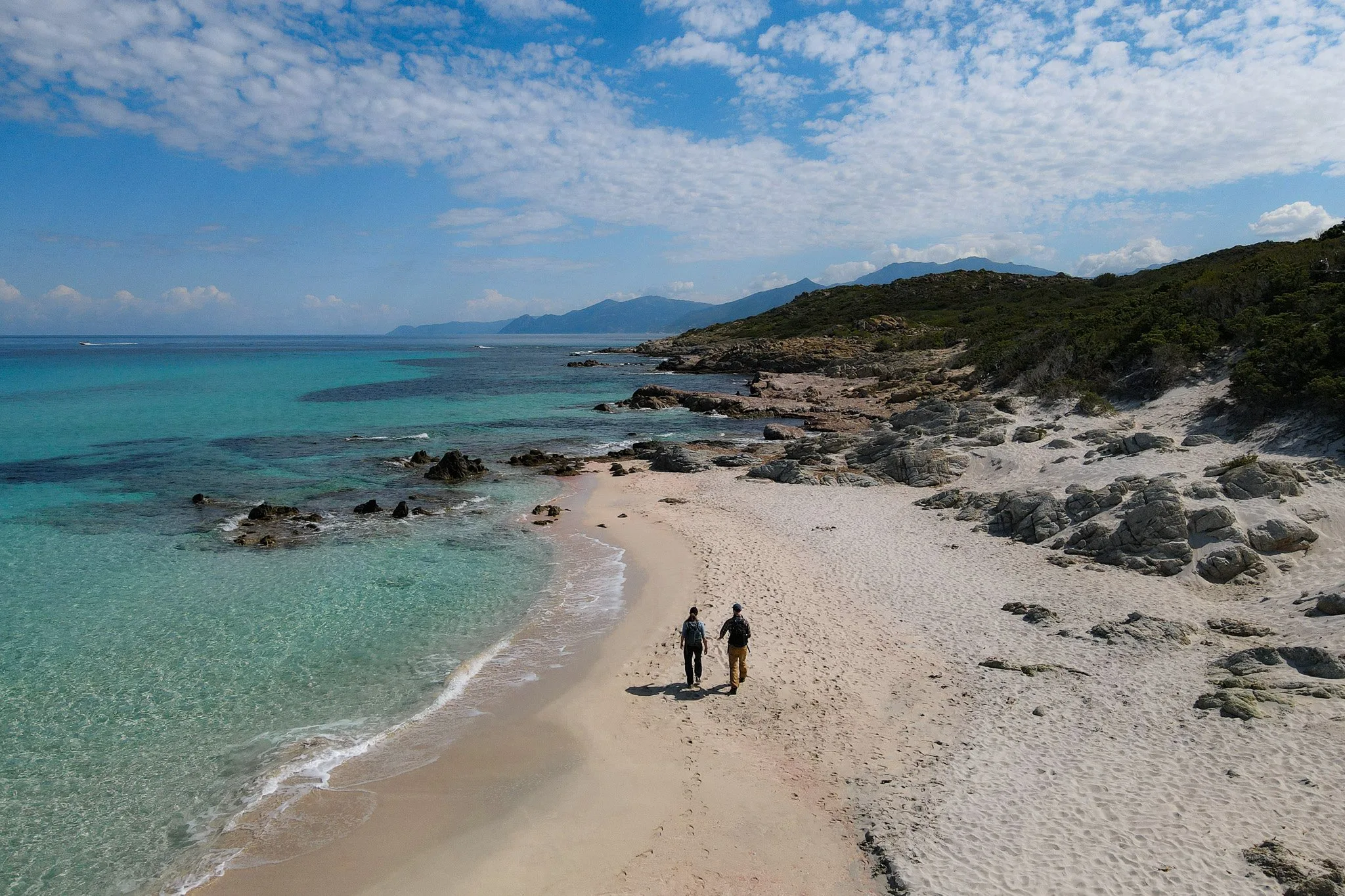
Also, Sentier du Facteur Girolata is another excellent walk north of Calanques de Piana.
Other Ways to Explore Calanques de Piana
At Travel Made Me Do It, we’re all about hiking. So, true to form, we think hiking is the best way to explore Calanques de Piana.
But after hiking to your heart’s content, maybe you want to explore the area by car or by boat. Let’s look at these options below.
Driving: Road Viewpoints
The D81 cliffside road, between Piana and Porto Ota, pierces through the heart of Calanques de Piana. For sure, driving this road is an absolute must during a visit to the area.
Having driven up from Ajaccio, we drove along this road en route to Porto Ota, where we stayed for two nights. Undoubtedly, this mountain road is one of the coolest we’ve ever driven! Not only are the views incredible, but you drive right alongside some mammoth rock formations.
Along the road, there are laybys, which allow you to stop and explore the surrounding area. Bear in mind that during peak times, these lay-bys are often full, and the road is chaotic with huge tourist buses. So, we think it’s best to explore the road earlier or later in the day, avoiding the group tours visiting during the middle of the day.


Guided Girolata Boat Tours

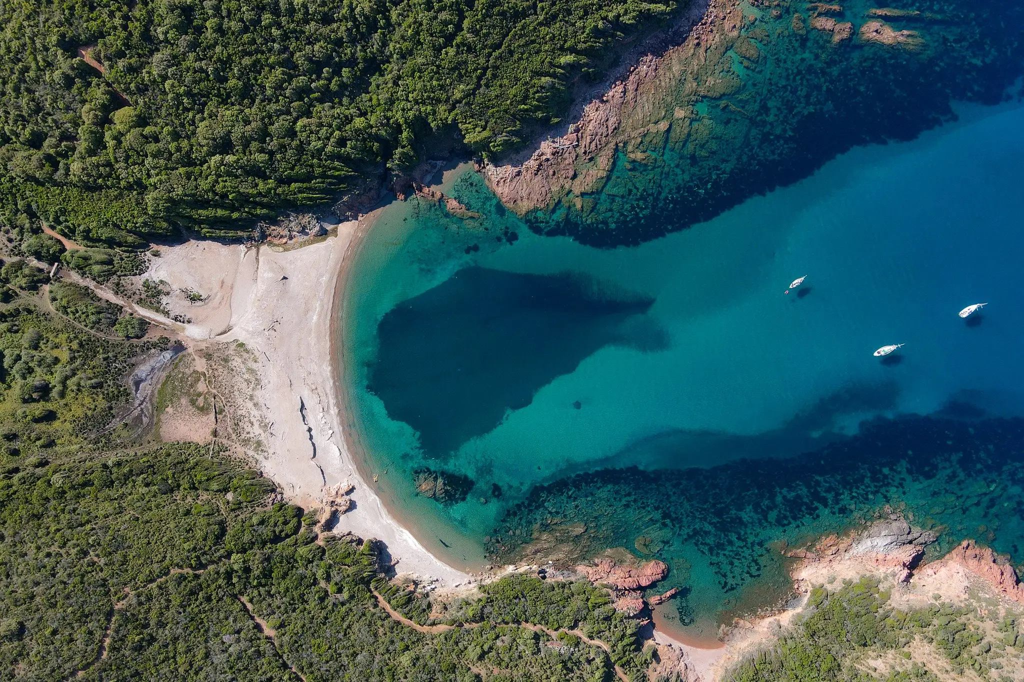
Another great way to explore Calanques de Piana is by boat. Many highly rated guided boat tours sail around the Gulf of Porto, offering exceptional views of the rocky landscape.
Corsica Hiking Guides
- Corsica Hikes Guide: The 17 Best Day Hikes in Corsica
- Sentier des Douaniers Cap Corse – The Ultimate Walking Guide
- Sentier des Douaniers Saint-Florent – The Ultimate Walking Guide
- Pointe de la Revellata – The Complete Walking Guide
- Sentier du Facteur Girolata – The Ultimate Hiking Guide
- Sentier du Château Fort Piana – The Complete Walking Guide
- Calanques de Piana Hike via Sentier Muletier (Piana Mule Trail)
- Capo Rosso Hiking Trail – The Ultimate Guide
- Sentier des Crêtes Ajaccio to Monte Salario Walk – Visitor’s Guide
- Sentier des Douaniers Ajaccio – Pointe de la Parata to Petit Capo
- Capu di Muru (Capo di Muro) – The Complete Walking Guide
- Sentier du Littoral de Campomoro – Tour de Campomoro Walk
- Sentier Littoral des Bruzzi (Sentier des Bruzzi) – Visitor’s Guide
- Capo di Feno Bonifacio Walk (Includes Sentier de Fenu)
- Strada Vecia Madonetta – An Excellent Coastal Walk in Bonifacio
- Campu Rumanilu – Bonifacio Cliff Walk (The Ultimate Guide)
Discover Other Hikes in Corsica
Are you interested in doing other hikes in Corsica? Learn about all the best day hikes in Corsica.
Where to Stay Near Calanques de Piana
Calanques de Piana is wedged in between the villages of Piana and Porto Ota. So, those staying in the area will find accommodation in either village.
Beck and I chose to stay in Porto Ota for the stunning location and the more budget-friendly accommodation. We had a memorable two-night stay at Hotel et Résidence Cala di Sole in Porto Ota.
Where We Stayed in Porto Ota

- Budget-friendly and free parking
- Excellent location and views
- Outdoor swimming pool
Leave a comment