The Madrisa Hike to Ratschenhorn (AKA Ratschenflue) is one of the most underrated hikes in Switzerland. In this guide, we’ll nicely recap everything you need to know about doing this lesser-known walk in the Davos Klosters area.
Table of Contents
Madrisa Hike Options
Madrisa inherently refers to the area surrounding the Madrisa Cable Car Station. The area features an adventure park (Madrisa Land), accommodation and dining options, and beginner-friendly skiing and hiking trails. So, it’s a popular place for families to visit.
Madrisa is also short for the Madrisahorn, which is the landmark mountain in the Klosters region.
In the summer, the Madrisa Cable Car Station acts as a trailhead for many hiking trails. There are many short, easy and even themed trails around the station. There are also more challenging multi-day and single day hikes into the mountains surrounding Madrisahorn.
The more well-known multi-day hiking options include the Madrisa Round Tour and Prättigauer Höhenweg. There is also the Madrisa Trail Klosters trail running event.
Given the number of walking tracks around Madrisa, there are many different single-day hiking options to consider. We chose to do the Madrisa Hike to Ratschenhorn.

The Madrisa Hike to Ratschenhorn
The Madrisa Hike to Ratschenhorn is an excellent 12km circular trail option using the Madrisa Cable Car Station as its trailhead. It’s one of the best loop trails, exploring some of the most spectacular peaks near the Madrisahorn.
In particular, Ratschenhorn (AKA Ratschenflue) is a lesser-known yet spectacular limestone-capped mountain worth visiting.
We chose this option because we didn’t have time for a multi-day hike. Also, we preferred a loop option that would conveniently start and end at the Madrisa Cable Car Station.
Below, let’s look at the trail specs for the Madrisa Hike to Ratschenhorn.


Madrisa Hike to Ratschenhorn Details
- Type: Loop
- Distance: 12km
- Time: 5–6 hours
- Accumulated elevation gain: 870m
- Difficulty: Hard
- Trailhead: Madrisa Cable Car Station
- Map: AllTrails
Bear in mind that this is a very physically demanding hike. Navigation is also tricky at times. That’s partly because the route isn’t overly popular, and so some of the trails involved are faint and hard to follow. Admittedly, this hike isn’t suitable for beginners unless you’re with someone experienced in mountain hiking.
Travel Insurance


Don’t leave for your trip without booking travel insurance. We all know accidents can happen and having Heymondo travel insurance could save you thousands of dollars if something goes wrong. Click the button below to receive a 5% discount!
Madrisa Hike to Ratschenhorn Map
This illustrated map nicely depicts the Madrisa Hike to Ratschenhorn.


Given the hike’s difficulty, make sure to have a map to hand. I had a hard copy map, which you can usually pick up for free at cable car stations in the Davos Klosters area. But I mostly used this digital AllTrails map.
How to Get to Klosters Dorf
To do the Madrisa Hike to Ratschenhorn, take the Madrisabahn cable car (gondola) from Klosters Dorf to Madrisa.
You can either drive to or take the train (plus or minus a bus) to Klosters Dorf. Beck and I hired a car for our Davos Klosters trip from Zurich Airport. So, we drove to and parked at the Klosters Dorf cable car station car park, which is a large parking area.
Use the EasyPark app to pay for parking.
Car Hire


If you don’t have your own car, you should hire one using Discover Cars. Personally, we use Discover Cars and highly recommend them for finding your ideal car hire at an affordable price. Booking online is super easy and the free cancellation policy is great.
To find out more about renting a car with Discover Cars, read our Discover Cars review and Discover Cars Insurance review.
Madrisa Cable Car (Gondola)
Once you arrive at Klosters Dorf, head to the Madrisa Cable Car Station to purchase your tickets for the Madrisabahn.
Personally, we paid CHF 13 each, which was a discounted price for having the ‘Premium Card’. At the time of writing, this card was given to visitors staying in Davos, offering considerable discounts on public transport.
Head to the Davos Klosters Mountains website for up-to-date details about costs and departure times. We arrived for the earliest ride, which was 8:15am at the time of writing.
In and of itself, the cable car ride is a fun experience, offering breathtaking scenic views of Klosters. Soon enough, you’ll arrive at Madrisa, ready to start the hike to Ratschenhorn.
Madrisa Hike to Ratschenhorn: Our Experience
Here, we’ll briefly run through our experience doing the hike. By doing so, we’ll cover the main points of interest along the route.
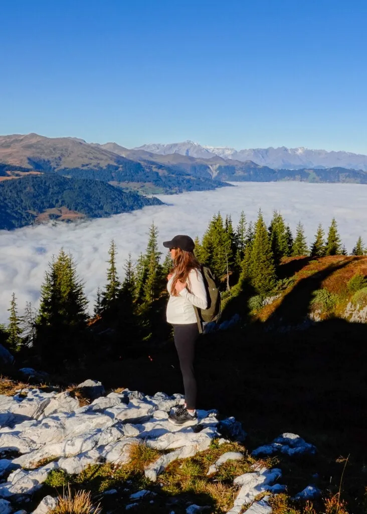
Given that Beck was pregnant at the time, she wasn’t able to join me for the entire hike. She joined me for the hike from Madrisa to Massplatte (under 2,000 metres). From Massplatte, I headed up into the mountains, re-joining her (and bump) upon my return to Madrisa.
Madrisa
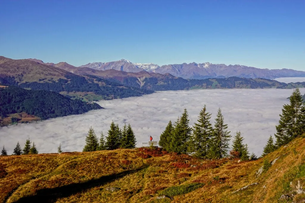
From Madrisa, Beck and I passed much of the Madrisa Land adventure park and headed to a viewpoint called Massplatte. As we gained elevation, we started to enjoy superb views of a cloud inversion filling the valley of Prattigauer.


Massplatte
From the viewpoint at Massplatte, we enjoyed immense views of the cloud inversion. After flying the drone and soaking in the views with Beck, I headed into the mountains solo.

At Massplatte, I left Beck to enjoy the views as I headed up into the mountains. I huffed and puffed as I hiked up a steep and winding trail.
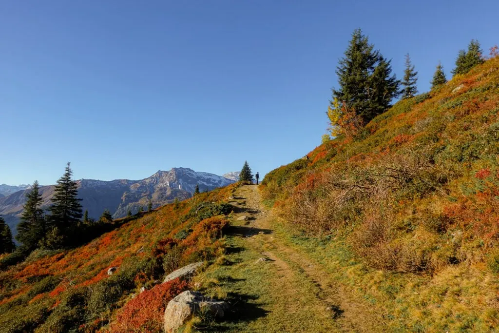
En route to Ratschenhorn, you’ll reach some minor peaks along the way, including Geisshorn (2,276m) and Bockhorn (2,352m).
The mountain scenery on offer during this part of the hike is absolutely sensational!


Saaser Calanda
You’ll soon arrive at a stunning peak called Saaser Calanda (2,584m). This mountain is comprised mostly of limestone boulders and platforms. Weaving and dodging your way through the rocky terrain is a thrilling part of the hike.


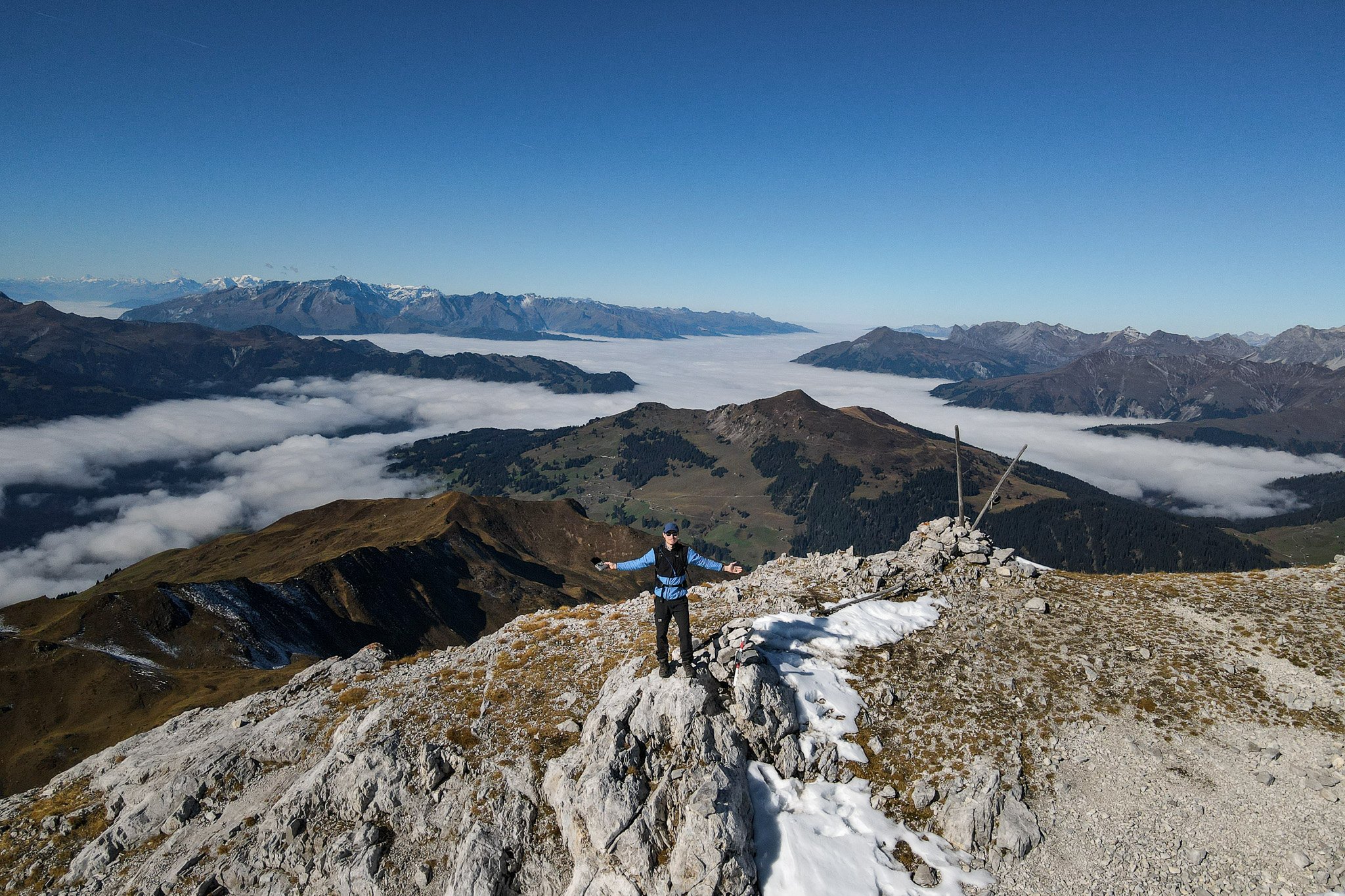
Ratschenhorn (Ratschenflue)
Sasser Calanda certainly sets the scene for your arrival at Ratschenhorn (2,703m). The mountain’s summit is a massive limestone plateau. From the plateau, you’ll enjoy unforgettable panoramic views of the Alps.
To the east, towards the Austrian Alps, at a nearer distance, you’ll enjoy magnificent views of Madrisahorn. In the opposite direction, you’ll have sweeping views of Prattigauer. Despite the hours passed on the hike from Madrisa to Ratschenhorn, I was lucky enough to still enjoy the amazing cloud inversion spread over the valley of Prattigauer.


At the peak of Ratschenhorn, there is note book for hikers to record their names. Once I wrote a message, I found myself a rock platform to sit, eat lunch and enjoy the views. Before setting off, I flew the drone (check out the footage in this YouTube video).
From Ratschenhorn, you’ll head towards a high mountain pass called Ratschenjoch (2,601m). Along this section, you’ll hike towards Madrisahorn, so you’ll enjoy increasingly fantastic views of this mountain. Undoubtedly, this is one of the highlights of the Madrisa Hike to Ratschenhorn.


Obersass
From the high mountain pass of Ratschenjoch, you’ll commence a steep descent back towards Madrisa. The zig-zagging switchbacks eventually give way to a more winding, undulating direct route.
You’ll eventually reach a viewpoint called Obersass. From there, you’ll enjoy an excellent vantage point of Madrisa Land, dwarfed by the surrounding Swiss Alps.
From Obersass, you’re just a stone’s throw from Madrisa!


Once back at Madrisa, I met up with Beck, and we headed back down the cable car and on to our next adventure (Sertig Waterfall).
Other Hikes in Davos Klosters
- The 10 Best Davos Hikes: Your Davos Klosters Hiking Guide
- Joriseen Hike, Davos: How to Visit the Epic Joriseen Lakes
- Madrisa Hike to Ratschenhorn (Ratschenflue): The Ultimate Guide
- Rinerhorn Summit Hike, Davos: Everything You Need to Know
- Davos Panoramaweg (Davos Panorama Trail) Hiking Guide
- Schiahorn Summit Hike, Davos: The Ultimate Hiking Guide
- Hike (Not Bike) the ‘Alps Epic Trail Davos’ From Jakobshorn to Sertig
- Sertig Waterfall (Ducan Waterfall): The Complete Visitor’s Guide
- Davosersee Rundweg (AKA Lake Davos Trail) – Visitor’s Guide


Klosters Accommodation
Despite Klosters having fewer accommodation options than Davos, it’s a more convenient location to stay in, with the Madrisa Hike to Ratschenhorn in mind. Klosters has plenty of rustic skiing-village vibes. So, if you’re after that traditional Swiss village charm, stay in Klosters.
Davos Accommodation
Most people hiking in the Davos Klosters area will stay in Davos as it has a lot more accommodation options. Given that Beck had a work event in Davos, we opted to stay there rather than Klosters.
Where We Stayed: Solaria
Admittedly, the high street of Davos, which is home to many of its accommodation options, is quite built-up and fairly busy. Beck and I chose to stay in Solaria, a quiet neighbouring town of Davos Dorf.
We had a lovely stay at Serviced Apartments by Solaria. Given how expensive Switzerland is, we wanted to stay in an apartment so that we could do our own cooking. This self-catering apartment featured a spacious kitchen and dining area. It was a fantastic base for our time hiking in the Davos Klosters region.
Serviced Apartments by Solaria


- Quieter area of Davos
- Modern apartments and facilities
- Balconies with gorgeous mountain views
Leave a comment